Merritt Island

Brownfields Grant Program

What is a Brownfield?

Contaminated Property

“A brownfield is a property with which the expansion, redevelopment, or reuse  may be complicated by the presence or potential presence of a hazardous substance, pollutant, or contaminant.

It is estimated that there are more than 450,000 brownfields in the U.S. Cleaning up and reinvesting in these properties increases local tax bases, facilitates job growth, utilizes existing infrastructure, takes development pressures off of undeveloped, open land, and both improves and protects the environment.” – U.S. EPA

About the Merritt Island Brownfields Grant Program

MIRA’s First EPA Grant

In 2022, MIRA was awarded a $500,000 assessment grant by the U.S. Environmental Protection Agency (EPA). An assessment grant helps cover the cost of a Phase I and Phase II environmental assessment for potentially contaminated sites. 

The Phase I Environmental Site Assessment (ESA) uses existing information to help a community understand the property conditions by examining current and historical uses of the site and potential threats to human health or the environment. Environmental assessments must be completed or overseen by an environmental professional, which may include a licensed geologist, engineer or site professional.

Source: EPA

The Phase II Environmental Site Assessment (ESA) is recommended if the Phase I Environmental Site Assessment results reveal known or potential contamination found on the property, sometimes called recognized environmental conditions (RECs). An environmental professional develops a sampling plan to evaluate the potential presence of contamination from hazardous substances and petroleum on the property and determines the sources and exposures.

Environmental professionals may also consult with state and tribal brownfield programs regarding required assessment activities.

Source: EPA

What are the First Steps for the Program?

Executing the Work

> Community Engagement

> Site Selection

> Work with selected site owners to obtain permissions and site access

> Phase I Environmental Assessment and determination of likely contamination

> Phase II Environmental Assessment 

We’re Here To Help
Your Business

Through Planning, Partnerships,
Infrastructure, Financing Tools & Grants

Dedicated to Sustainability & Economic Growth in Merritt Island

MERRITT ISLAND REDEVELOPMENT ZONES

There are four (4) sub areas within the Merritt Island Redevelopment Area consisting of:

SR 520 Commercial Core Sub-Area (Merritt Island Causeway), adopted 1989 (745.53 acres) and 1991 (280.12 acres), is the primary west/east major arterial road, extending from the Indian River Lagoon on the west and the Banana River Lagoon on the east. It extends north to approximately Merritt Avenue and south to approximately Fortenberry Road.

SR 3 Sub-Area, adopted 2006 (165.7 acres), is the primary north-south corridor through Merritt Island and includes all properties that front on Courtenay Parkway from the SR 528 interchange at the north end to Merritt Avenue at the south end.

Barge Canal Sub-Area, adopted 2012 (981.01 acres), includes SR 528 and the lands to the north that front on the Barge Canal. It extends from the Indian River Lagoon on the west to the Banana River on the east.

Cone Road Sub-Area, adopted 2012 (209.53 acres), encompasses the industrial lands located south of Cone Road and north of the Merritt Island Airport.

Filter by
TitleCategoryAddressDescriptionLink

Get Directions

show options hide options

OUR PARTNERS

Investing in Merritt Island

Major Investments Coming To Merritt Island

0M
Health First Medical Wellness Village
0M
Capital Improvement Investments
0M
S Courtenay Pkwy Infrastructure & Image Enhancement Project
0M
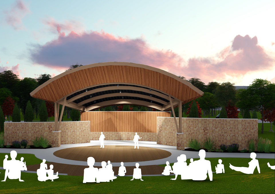
Veterans Memorial Park Amphitheatre Project