REDEVELOPMENT
IN ACTION
an island of opportunities
REDEVELOPMENT
IN ACTION
an island of opportunities
INITIATIVES
- 10-year commitment to funding the Sea Ray Drive Bridge Infrastructure Project, via Partnership Agreement with Brevard County Board of County Commissioners
- In conjunction with Sea Ray Drive Bridge Project, Merritt Island Barge Canal Corridor Improvements Concept Planning; partnering with Public Works, State of Florida, Port Canaveral, and Private Sector based Land Owners
- Implementation of Redevelopment/Economic Development based MIRA Website and Social Media outreach strategy
- Zoning Overlay Districts for Mall Commercial Core and Medical Office areas
- Update of the Merritt Island Redevelopment Plan
- $2.6 Million Dollar Veterans Memorial Park Amphitheatre Project, in design and engineering phase
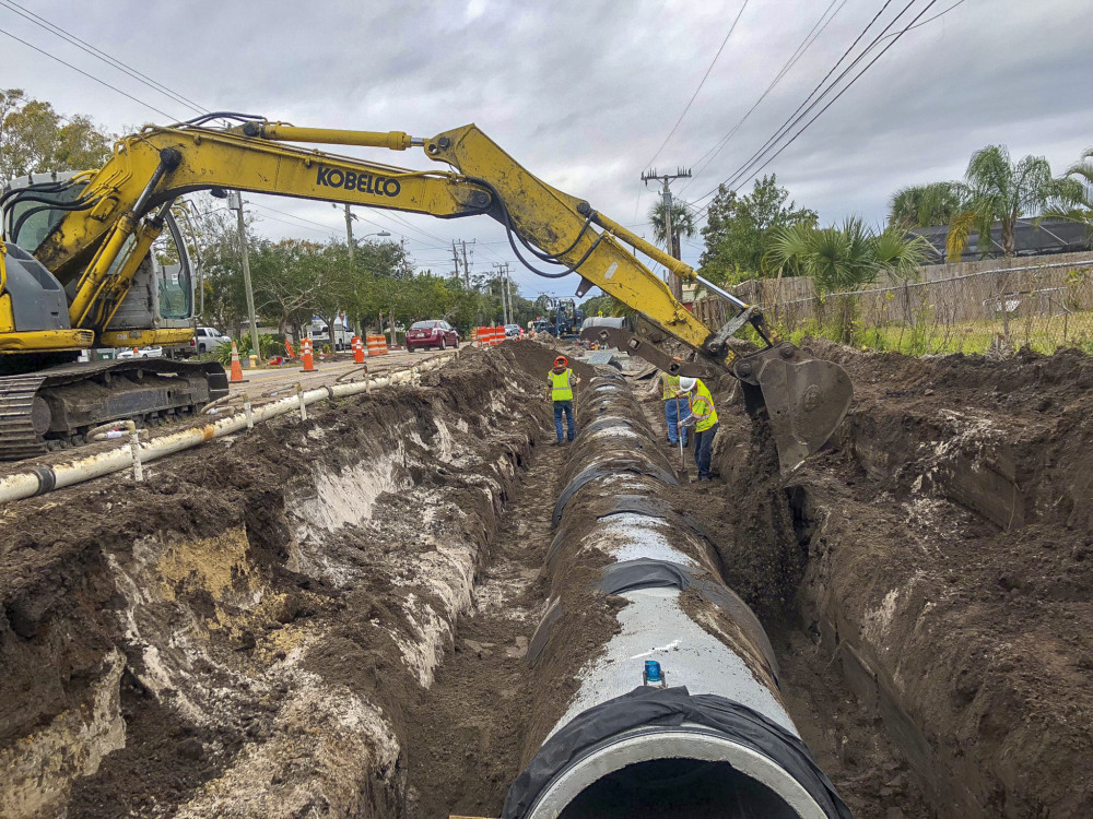
- North S.R. 520 Stormwater Project
- $2.2 Million South Courtenay Parkway Fortenberry to Cone Road Infrastructure and image enhancement project through partnering with Public Works
- Funding of more than $500,000 of improvements to Historic Griffis Landing at Blue Crab Cove
What Does Redevelopment Look Like?
60 McLEOD
Historic Merritt Park Place


HOBBS PHARMACY
520 Corridor


123 TANGERINE AVE.
Historic Merritt Park Place


Dedicated to Sustainability & Economic Growth in Merritt Island
![]() The mission of the Redevelopment Agency is to create and implement community-based redevelopment strategies that promote quality growth and economic development, preserving Merritt Island’s history, culture and natural environment, and improving the quality of life for residents, workers, and visitors. Project planning and execution is funded through various sources, including Tax Increment Financing (TIF), grants, and donations.
The mission of the Redevelopment Agency is to create and implement community-based redevelopment strategies that promote quality growth and economic development, preserving Merritt Island’s history, culture and natural environment, and improving the quality of life for residents, workers, and visitors. Project planning and execution is funded through various sources, including Tax Increment Financing (TIF), grants, and donations.
OUR PARTNERS


Investing in Merritt Island
Major Investments Coming To Merritt Island
0M
Health First Medical Wellness Village
0M
Capital Improvement Investments
0M
S Courtenay Pkwy Infrastructure & Image Enhancement Project
0M
Veterans Memorial Park Amphitheatre Project